
BROOKLYN CENTER, Minnesota — For nearly a decade, talks and plans have gone back and forth on what to do about Highway 252. According to the Minnesota Department of Transportation (MnDOT), five of the top 100 most dangerous intersections are on Highway 252.
MnDOT is looking to improve and repair Highway 252 and I-94 in Brooklyn Center, Brooklyn Park, and north Minneapolis — citing the high number of crashes, traffic congestion, and "significant barriers" for pedestrians and bicyclists in the area. MnDOT is currently seeking public comments for the Highway 252/I-94 project.
But the alternatives proposed are receiving pushback from a safety task force group over concerns of safety, traffic, air pollution, environmental effects, and equity.
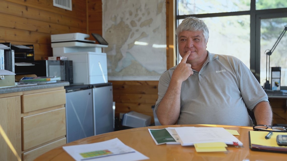
"The more we learn, the more alarmed we are frankly," said Bill Newman, who lives in the Riverwood neighborhood of Brooklyn Center.
Years ago, Newman and a group of concerned residents in Brooklyn Center got together over MnDOT's initial ideas for the highway. They formed the Highway 252 Safety Task Force, a recognized group by the city of Brooklyn Center.
While standing on the corner of 66th Avenue North and Highway 252, task force member Stephen Cooper said, "If you look down there, less than a third of a mile away is 694, 94, Highway 100 all coming together. They want to put an interchange right where the gas station is. That'll kill people."

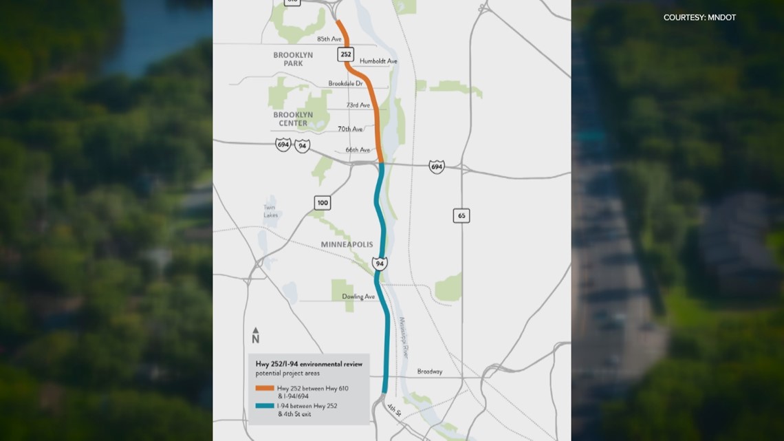
In March, MnDOT released a draft scoping decision document, narrowing down design alternatives from more than 40 to three options recommended for further study.
The project alternatives:
4-lane freeway with bus-only shoulders
6-lane freeway with two managed lanes
6-lane freeway with bus-only shoulders
MnDOT said in a city council meeting that the fourth option, leaving the existing road, is a requirement for the Environmental Impact Statement (EIS) process.
MnDOT would not go on camera for an interview with KARE 11 during the public comment period but Project Spokesperson Ricardo Lopez said in a statement, "The years-long effort is intended to improve the safe and reliable movement of people and goods across multiple modes of transportation, including walking and biking."
MnDOT's project objectives include achieving equitable social, environmental and economic outcomes; reducing injuries and fatalities; supporting reliable transit services; minimizing the need to acquire additional property; and ensuring solutions are consistent with local planning and compatible with the existing roadway network.
Newman said a proposed interchange at 66th would result in an unsafe distance for merging.
"Ideally, if you're in a rural area, the rule is two miles apart. The reason for that, imagine if you're one of the people that's actually driving the speed limit, 60 mph. You're going a mile a minute. Every minute you pass a mile. In urban areas, they reduce that because it's hard to space interchanges every two miles; they cut it in half to one mile. The interchange at 66th is less than a third of a mile," Newman said.
While MnDOT's road design manual on interchange spacing states the minimum "desired amount" is one mile, MnDOT said, "There's no state or federal regulation that specifies the minimum distance between interchanges." MnDOT went on to say that interchange spacing and the distance between interchange ramps are not the only factors that highway engineers consider when locating and designing interchanges.
As part of the Highway 252 project, MnDOT completed a comprehensive safety analysis of interchanges in the Twin Cities metro area.
"This analysis concluded that tightly spaced interchanges have similar overall crash rates when compared to interchanges spaced greater than one mile. Tightly spaced interchanges, however, have a noticeably lower average severe crash rate when compared to interchanges spaced greater than one mile."
Newman said the distance between on and off-ramps is also concerning.
"It reduces the distance between the nose of the on-ramp at 66th to the nose of the off-ramp for 694. MnDOT has very specific rules. So the nose being where you hit the straightaway, their rules state that the desired distance is 3,000 feet, an adequate distance is 2,500 feet, the absolute minimum is 2,000. The last design that they put on paper was 830 feet and the crash rate goes up exponentially as you get below that 2,000 feet absolute minimum distance," Newman said.

Newman adapted a crash curve using National Cooperative Highway Research Program data to project crash rates would increase by 45%.
Through a Freedom of Information Act request, the task force obtained non-public Technical Advisory Committee (TAC) meeting presentations.
"The draft scoping document is pushing the six-lane freeway options but notes that these are the least safe freeway options with network crash safety rated 'poor' and mainline crash safety rated only 'fair,'" Newman said.
Newman went on to say, "If MnDOT is going to spend over $120 million per mile, we should demand better than 'poor" and 'fair' safety."
Meanwhile, a four-lane low-speed freeway has a "good" rating for mainline crashes.
In the draft scoping document, MnDOT eliminated expressway options which the task force believes would do less harm to the community. During Monday's Brooklyn Center City Council meeting, Leif Garnass, an SRF Consulting Group traffic engineer, said expressway alternatives were not recommended due to "minimal safety benefits and minimal benefit for people walking and biking."
"The task force would only support a freeway if it had interchange options that had safe spacing and safe design," Newman said.
On top of safety, the task force has other concerns about how it could affect the communities.
"Unlike where the other highways go, you're right on top of people's houses. When you're right on top of people's houses, the pollution effects, the illness effects, the loss of property effects, the sound effects are all dramatically amplified," Cooper said.
Cooper is one of two current task force members (out of a group of seven) that would have direct potential impacts on their property if an interchange was located at 66th. The largest number of direct property impacts (101 houses, one multi-family, 11 businesses, one church, and two parks) would occur with interchanges at 85th + Brookdale/73rd + 66th.
During Monday's city council meeting, several council members raised concerns about losing property tax revenue due to the project. Local governments will have to give municipal consent to any design.
There are also environmental concerns with the road being near the Mississippi River.
"We have all of the wells for the Brooklyn Center city water supply on the west side of 252 between 73rd and 694 and the capture zone. So the zone where all the water flows toward those wells goes from as far as the Mississippi, almost down to 694, all the way north to 73rd. If we had heavy truck traffic and we had a toxic spill, that could wipe out our water supply," Newman said.
During the city council meeting, MnDOT West Area Manager Mark Lindeberg addressed the issue, saying, "All of the alternatives advancing will certainly be designed to address water runoff of the roadway and treatment of the water. We will be implementing measures to make sure that we prevent groundwater pollution. As far as contamination goes, with respect to a crash or overturned tanker truck, we've got protocols in place in order to capture that as quickly as humanly possible. We're not just turning a blind eye to contamination freely flowing into the river."
The task force also has concerns over air pollution, more traffic and equity. The project affects communities consisting of a majority of BIPOC residents.
"We're funneling traffic from more affluent communities from far away and we're funneling it down that 252/94 corridor that's already heavily impacted by air pollution, and traffic, and freeways," Newman said.
He went on to say, "We try not to play the personal stuff too much but one of our task force members lost their son to a crash at 73rd. So having them spend that kind of money and still leave it deadly dangerous is scary because it's going to lead to shattered lives... they're going to sacrifice our safety. That's not acceptable."
According to MnDOT, any large-scale construction would not happen until, at the earliest, 2026.
MnDOT invites the public to attend upcoming public meetings to learn more about the potential alternatives proposed and give their feedback.
In-person meeting:
April 18
4:30 to 7:30 p.m.
Discover Church
1400 81st Ave N. in Brooklyn Park
Virtual meeting:
April 27
6:00 to 7:30 p.m.
Register here.
The public comment period will close on May 19. Comments can be submitted by email (Highway252andI94.DOT@state.mn.us), phone at 612-441-1928; online or by mail to Andrew Lutaya, Project Manager, Minnesota Department of Transportation, 1500 West County Road B2, Roseville, MN 55113.
Watch more Breaking The News:
Watch all of the latest stories from Breaking The News in our YouTube playlist: