
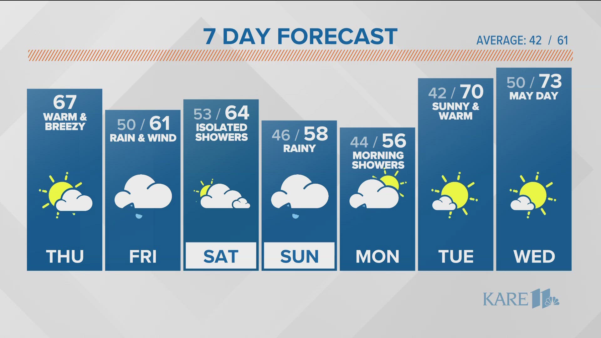
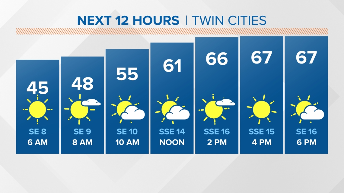
MINNESOTA, USA — Thursday looks beautiful with highs warming into the upper 60s with breezy southeast winds at 10-20 mph. Rain threats are off today before ramping up into Friday morning.

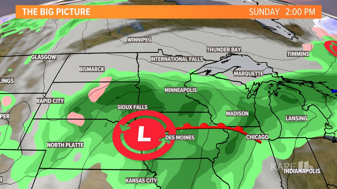
Back to back, low-pressure centers are set to move in on Friday and once again on Sunday. Showers will be likely by Friday morning before some clearing is expected Saturday. This could give us a chance to dry out for a bit and warm up before the next wave of rain is expected into Sunday morning.

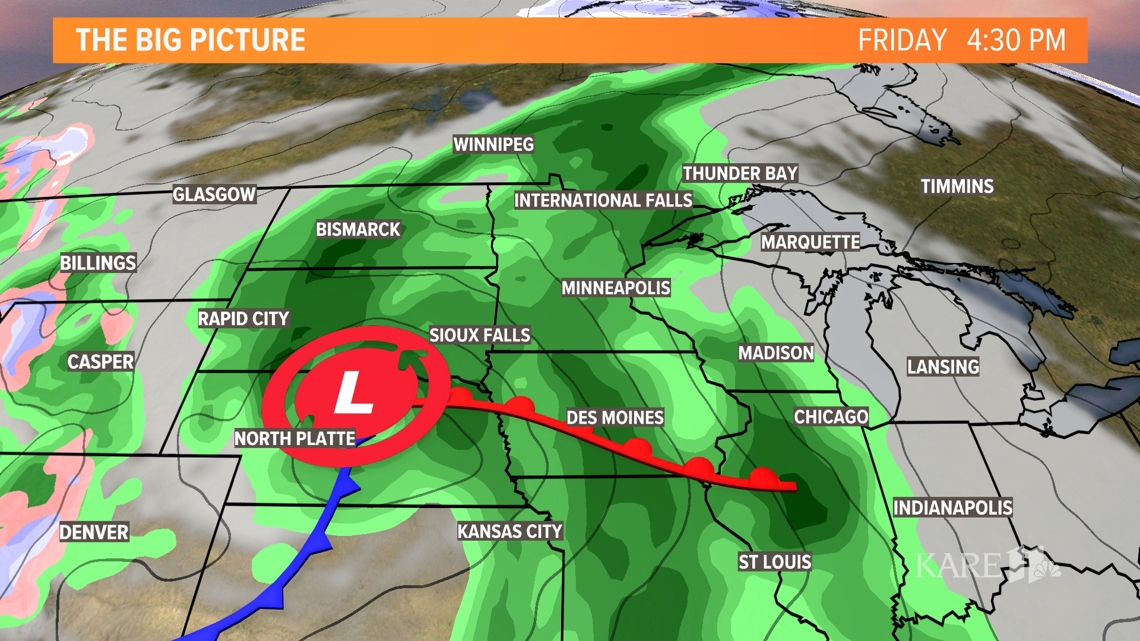
Saturday may not be completely dry with a few showers in the morning, but most of the day looks mostly cloudy and rain free. Rain chances move into Wisconsin during the evening and severe weather should also stay east.

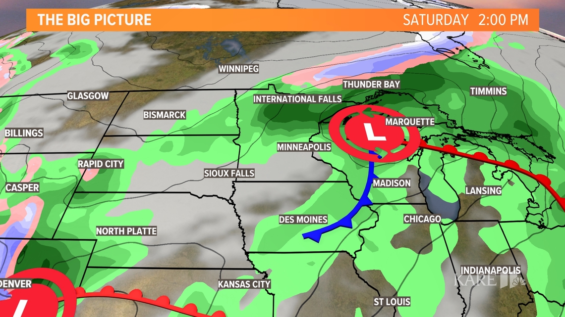
Another area of moderate to heavy rain is expected on Sunday morning and could linger throughout the entire day. Severe threats once again will stay just to our south in Iowa and southwest Wisconsin.

Overall, the next week looks fairly wet with rain possible each day from Friday through Monday. Much warmer and drier air is set to move in during the middle of next week.

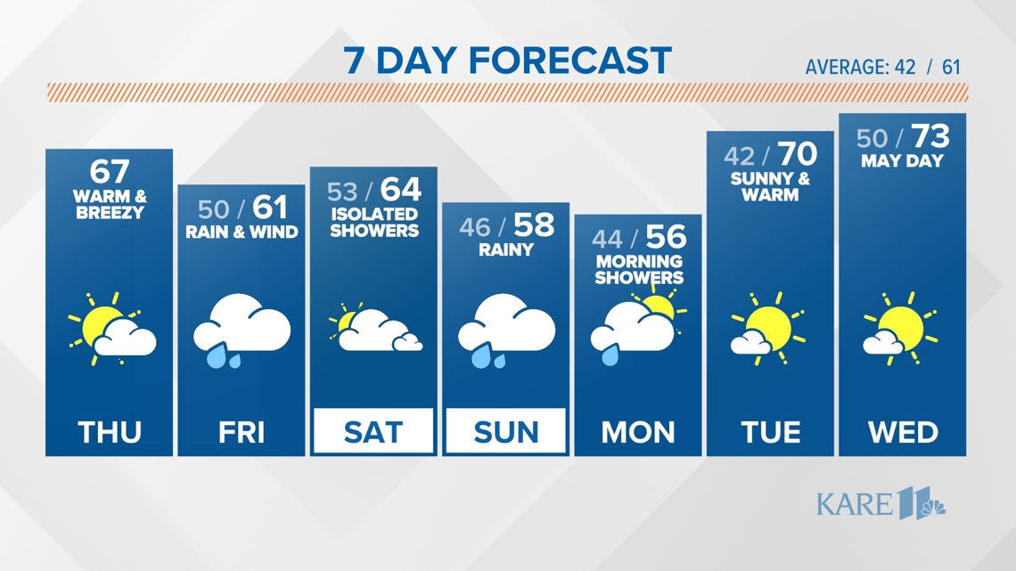
Looking beyond rain chances this week, temperatures will remain fairly steady with only minor swings in the numbers.
Text your weather-related photos or videos to 763-797-7215. While you're at it, save KARE 11 as a contact on your phone!
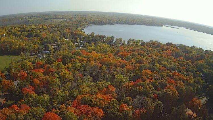
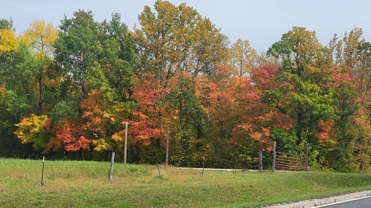
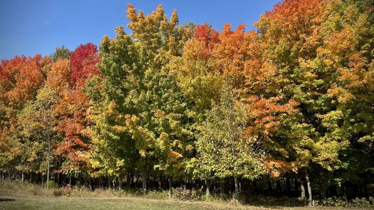
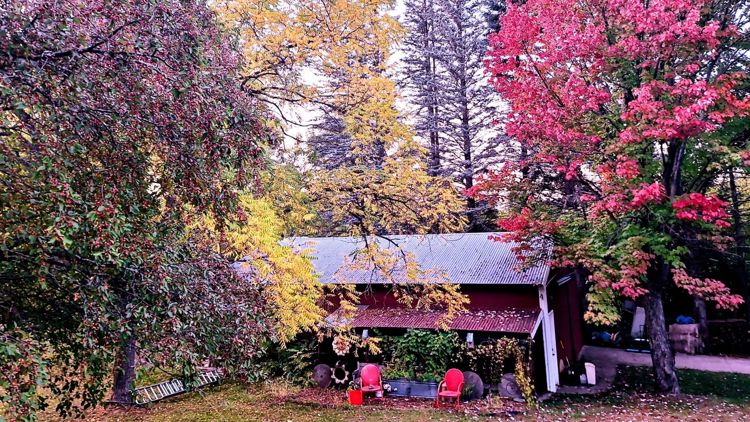
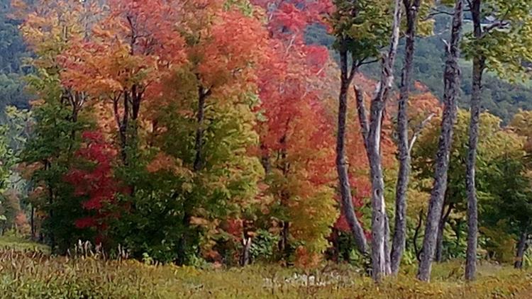
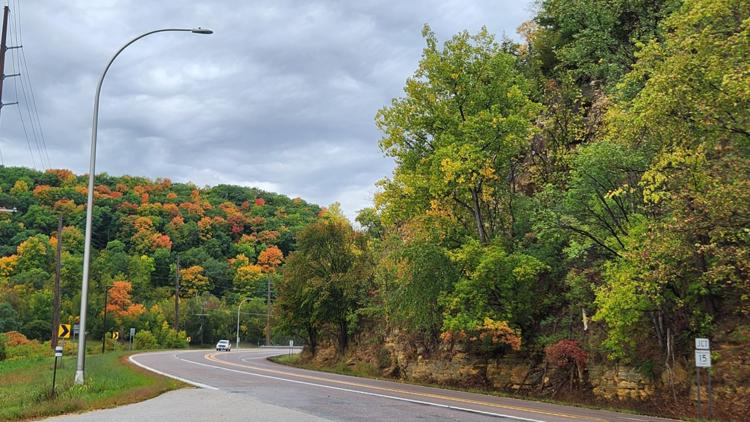
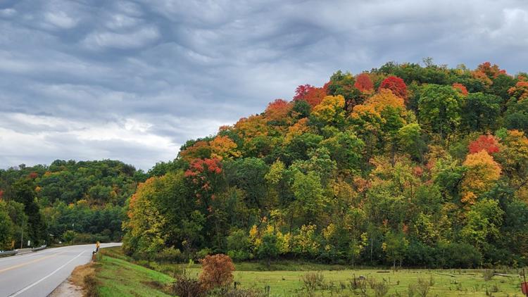
PHOTOS: Fall colors popping across Minnesota


WATCH MORE ON KARE 11+
Download the free KARE 11+ app for Roku, Fire TV, Apple TV and other smart TV platforms to watch more from KARE 11 anytime! The KARE 11+ app includes live streams of all of KARE 11's newscasts. You'll also find on-demand replays of newscasts; the latest from KARE 11 Investigates, Breaking the News and the Land of 10,000 Stories; exclusive programs like Verify and HeartThreads; and Minnesota sports talk from our partners at Locked On Minnesota.
- Add KARE 11+ on Roku here or by searching for KARE 11 in the Roku Channel Store.
- Add KARE 11+ on Fire TV here or by searching for KARE 11 in the Amazon App Store.
- Learn more about the KARE 11+ app for Apple TV in the Apple App Store.
- Learn more about KARE 11+ here.
Watch more WeatherMinds:
Watch the latest deep dives and explainers on weather and science in our YouTube playlist: